Storm to spread snow in Midwest to end week; Will it become next snow threat for mid-Atlantic?
A new storm, an Alberta Clipper, will spread a swath of heavy snow across parts of the northern Plains and Midwest to end the week, before making an eastward turn over part of the mid-Atlantic region later this weekend.
Thanks to a stubborn blocking pattern with the jet stream, just enough cold air has lingered in the northeastern quarter of the nation to allow multiple storms to bring wintry precipitation to many areas.

Unless this pattern breaks down and becomes more progressive, additional storms that move in from the west have the potential to carry on the threat of winter snow and travel disruptions through the end of March and into early April.
The next contender for such wintry trouble will be a storm that is forecast to roll southeastward from Alberta, Canada, late this week.
Snowy travel for some to end the week
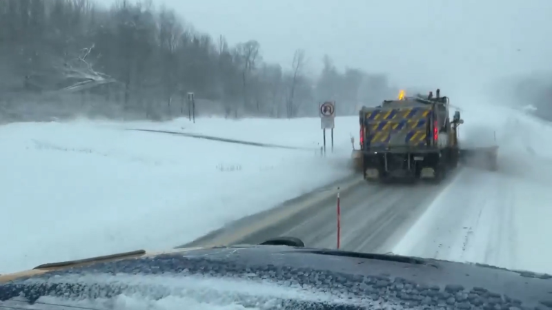
While the exact swath of heavy snow may shift, areas from northwestern North Dakota through Illinois and western Virginia are at risk for several inches of snow, slushy and slippery roads and airline delays.
Cities currently within the projected swath of moderate to heavy wintry precipitation include Minneapolis and Rochester, Minnesota; Fargo and Minot, North Dakota; La Crosse and Madison, Wisconsin; Dubuque and Cedar Rapids, Iowa; and Rockford and Peoria, Illinois; from Friday to Friday night.

A slight shift in the storm track may bring heavy snow to Chicago.
Farther to the southeast, temperatures may be low enough to allow several inches of wet snow or a wintry mix in Indianapolis and Terra Haute, Indiana, Cincinnati, Ohio, and Morgantown and Charleston, West Virginia, on Saturday to Saturday night.
Potential for snow to shift northward in mid-Atlantic this weekend
While the latest trend is taking precipitation farther south in the East this weekend, that trend may not hold up as the storm gets closer.
During this weekend, a large wedge of dry, cold air will hover over New England and much of the mid-Atlantic. This big batch of cold air will be held in place by the recent snowstorm that will run its course on Wednesday and Thursday.
"How far north snow is able to fall in the mid-Atlantic during Saturday night and Sunday will depend on how strongly dry air holds on," according to AccuWeather Lead Long-Range Meteorologist Paul Pastelok.
On one hand, snow may spread across northeastern Ohio, Pennsylvania, northern Maryland, Delaware and New Jersey.

On the other, some wintry precipitation may fall farther south across West Virginia, Virginia and North Carolina.
"We are concerned this area of snow shifts farther north as other storms have done this winter," according to AccuWeather Long-Range Meteorologist Max Vido.
Those with travel plans in Pittsburgh, Philadelphia, Baltimore and Washington, D.C., should monitor the progress of the storm as it may affect the trip to or from their destination.
A taste of spring, then winter may again fight back
"In the wake of the clipper storm this weekend the Atlantic Seaboard and Appalachians may get a several-day break from major storms and cold air much of next week," Pastelok said.
While next week may start blustery and cold, strong March sunshine should provide a boost in temperature as the week progresses.
However, a large storm may come about during the Easter weekend with the potential for wintry precipitation. Regardless of the primary form of precipitation from that storm, colder air will again cycle into the Upper Midwest and Northeast.
"Indications are that much of the first half of April is looking abnormally cold in the northeastern part of the nation," Pastelok said.
The long-range outlook is not very promising for those yearning to take on outdoor projects, sporting activities and early-season gardening in New England, the mid-Atlantic and the Great Lakes region.
Report a Typo


