Snow to sweep from Plains to Ohio Valley late this week
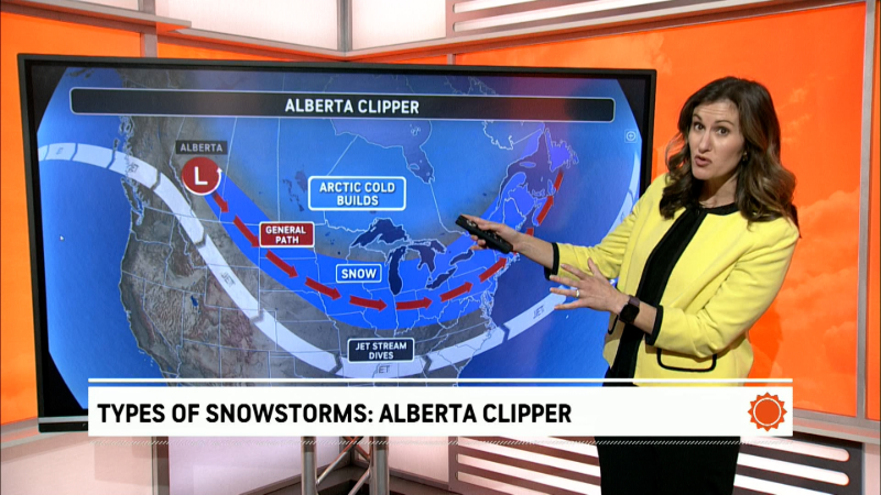
Following the outbreak of bitterly cold air through midweek, a fast-moving storm system will spread a swath of snow from the north-central Plains to the Ohio Valley into Thursday night.
Snow snow is then expected to streak into the central Appalachians and mid-Atlantic by Friday.
While snow will only last between 6 and 12 hours in any one location, the snow may come down hard and accumulate quickly on roadways and sidewalks, especially in areas that experience snow during the overnight hours.
The swath of accumulating snow may only be 100-200 miles wide, but areas within this swath could pick up this accumulation within a short amount of time.
“While this storm is not expected to become a significant storm by any means, it still has the potential to drop several inches of snow across a stretch from Rapid City, South Dakota; to Omaha, Nebraska; Des Moines, Iowa; and Cincinnati,” AccuWeather Meteorologist Isaac Longley said.

Longley warned that this amount of snow is still enough to disrupt travel plans and lead to snow-covered and slippery roadways.
Snow developed across much of Nebraska and southern South Dakota on Wednesday night and will spread eastward into Iowa and parts of Illinois and Indiana by Thursday afternoon.
It is in these areas that the system will likely be most potent and drop the highest snow totals.
“From 6 to 10 inches of snow can fall across parts of southern South Dakota and northern Nebraska,” Longley added.

An AccuWeather Local StormMax™ of 12 inches is forecast over part of the High Plains.
How strong the system remains by Thursday night and Friday will be determined by how quickly an area of high pressure shifts out of the Ohio Valley and mid-Atlantic.
A weaker high pressure system that departs more quickly would allow accumulating snow to reach southern parts of the Ohio Valley and central Appalachians.
However, a stronger high pressure system would cause snow to quickly dissipate and lose its intensity due to its running into drier, more stable air east of the Midwest.
In the worst-case scenario, a couple of inches of snow could pile up on portions of interstates 64, 70 and 75 in the Ohio Valley during Thursday night.
How much snow will fall in the Northeast?
This storm will continue to have issues with weakening as it moves farther to the east, and snowfall accumulation will continue to be affected by the time of day.
"There may be up to a couple of inches of snow over parts of West Virginia, western Maryland, southwestern and south-central Pennsylvania and northern Virginia during late Thursday night to Friday morning," according to AccuWeather Senior Meteorologist Alex Sosnowski.

"Where snow manages to streak eastward first thing Friday morning along the I-66, I-70 and I-76 corridors is where there may be just enough snow to make for a slippery morning rush hour from northeastern Virginia to northeastern Maryland and southeastern Pennsylvania," Sosnowski said.
It is unlikely that snow would accumulate on roadways close to the mid-Atlantic coast during Friday midday and afternoon given temperatures above freezing and a sun angle equivalent to early October.
"There could be a coating of snow on non-paved surfaces with wet roads near the mid-Atlantic coast during Friday afternoon," Sosnowski said. "It may even change to plain rain in much of the area during that time."
Regardless of timing and snowfall amounts, the biggest issues from this system should occur on secondary roadways, bridges and overpasses that typically remain a few degrees cooler than interstates and more heavily traveled roads.
A much stronger and more foreboding storm system will follow on the heels of this one, bringing the potential for heavy snow to the northern Plains and a severe weather outbreak to the Deep South this weekend.
Download the free AccuWeather app to stay up to date on the latest expected snowfall amounts in your area.


