Severe storms to renew flooding, damaging wind threat in midwestern US
The latest round of severe thunderstorms packing heavy rain will roll across part of the Plains and Midwest into Thursday night.
"The main impacts from the storms will be for areas of flooding rainfall and highly localized damaging wind gusts into Thursday evening," according to AccuWeather Storm Warning Meteorologist Eddie Walker.
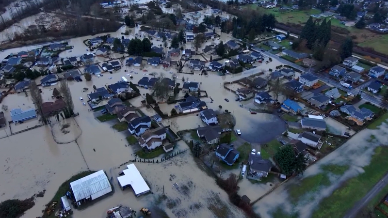
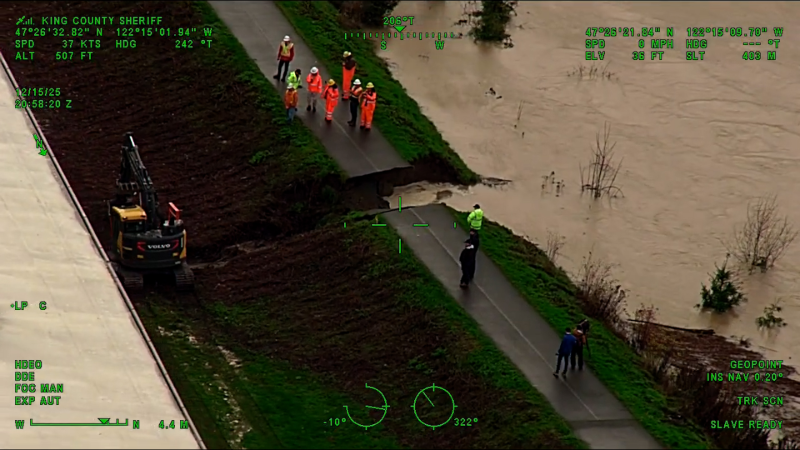
The storms and downpours will affect some communities dealing with ongoing high water and still cleaning up from storms earlier this month. Travel will slow to a crawl as storms cross major thoroughfares, and airline delays will mount as storms approach the major hubs.
"The storms will roll through a heavily populated area of the central United States and are likely to impact several major metro areas," according to AccuWeather Meteorologist Faith Eherts.

"People should be prepared for falling trees, power outages, flash flooding and travel delays as the storms move through," Eherts said.
Since some of the storms will move through at a fast pace, some people will be at risk for being caught outdoors and motorists may face rapidly changing conditions on the road, Eherts added.
The potential for gusty thunderstorms and flash flooding will also expand into the central and southern Appalachians.
Cities at risk for both strong, gusty winds and flooding downpours include Cincinnati; Evansville, Indiana; Nashville, Memphis and Knoxville, Tennessee; Huntington and Charleston, West Virginia; and Louisville and Lexington, Kentucky.
Locally severe storms are possible in parts of central and eastern Virginia during Thursday evening.
A rare late-July rainstorm may drench much of the mid-Atlantic later Friday through Saturday.
A large batch of cooler and less humid air will settle southeastward across the northern Plains and Midwest to end the week. This air will end the threat of severe weather for a two- to four-day stretch.
Report a Typo