Quick-hitting snowfall to sweep northeastern US prior to New Year's Eve
A fast-moving storm will bring enough snow to make roads slippery and cover the landscape in parts of the Northeast before New Year's Eve.
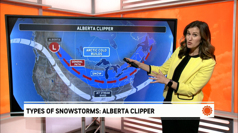
A storm from Montana that produced feet of snow will race off the mid-Atlantic and southern New England coasts on Saturday.
While the storm will struggle to find moisture because of its fast pace in the Eastern states, even a small amount of moisture can squeeze out a light to moderate accumulation.
The snow will be very fluffy. A mere 0.10 of an inch of water may yield 2 inches of snow or more.

A general coating to an inch or two of snow is forecast from the central Appalachians to the upper mid-Atlantic and southern New England coasts. A few locations will receive between 2 and 4 inches of snow, especially over the central Appalachians and perhaps on parts of coastal New Jersey, Long Island, New York and Martha's Vineyard and Nantucket, Massachusetts.
The ridges in northern West Virginia and south-central Pennsylvania received between 5 and 6 inches of snow.
Motorists should anticipate slippery conditions along portions of the Pennsylvania, New Jersey, Connecticut and Massachusetts turnpikes, as well as portions of interstates 68, 70, 78, 80, 81, 84, 87, 88 and 95.
Initially, slight melting of the snow on the roads may occur due to traffic. However, the formation of some ice is likely due to the frigid air before, during and after the storm. Bridges and overpasses will be the most susceptible to ice.
A multiple-vehicle crash related to slippery conditions closed the Schuylkill Expressway in Montgomery County, Pennsylvania, for a time during Saturday morning, according to WPVI-TV.
A separate 20-vehicle crash occurred on the Pennsylvania Turnpike, near Downingtown, Pennsylvania, Saturday morning.
Airline delays are likely due to deicing operations at the major hubs with the biggest delays likely in the stretch from Baltimore to Philadelphia and New York City.
Snow was diminishing over the central Appalachians as of the midday hours. The snow is forecast to taper off along the upper mid-Atlantic coast during the afternoon. Lake-effect snow will ramp up to the lee of the Great Lakes in the wake of the storm.
A couple of additional snow showers may occur in Washington, D.C. Snow is likely to bypass much of northern New England.
Any snow that falls from the storm around New York City is likely to stick around through New Year's Eve as temperatures again plummet in the wake of the storm. Revelers will face dangerously low AccuWeather RealFeel® temperatures below zero F.
Winds will kick up in the wake of the storm from Saturday and Saturday night.

Aside from areas prone to lake-effect snow, most of the time will be free of snow, ice and rain for the latter part of the New Year's Day weekend.
"A persistent northwest flow aloft will prevent storms from moving up from the Southern states from Sunday to [next] Tuesday," according to AccuWeather Long-Range Meteorologist Max Vido.
"At some point later next week, the flow aloft may shift and allow a storm to move northward along the Atlantic coast," Vido said.
Painfully cold air will pour in prior to the start of 2018.
Report a Typo


