Flooding downpours, severe storms to focus on southeastern US on Sunday
Just beyond the tree lines, a tornado is in the early stages of forming just outside of Havana, Illinois.
After an outbreak of tornadoes caused damage in Illinois on Saturday, the threat for severe weather and flooding will focus on the southeastern United States for the second half of the weekend.
An isolated tornado or two will once again be a concern on Sunday, and residents are reminded that it only takes one tornado to devastate a family or community.
Winds strong enough to cause damage to some property and trees, as well as power outages can also be produced. Outdoor holiday decorations should be properly secured to avoid potential damage.
Trees sitting in saturated soil may be more susceptible to being downed by gusty winds.

There can also be isolated incidents of hail with the strongest thunderstorms.
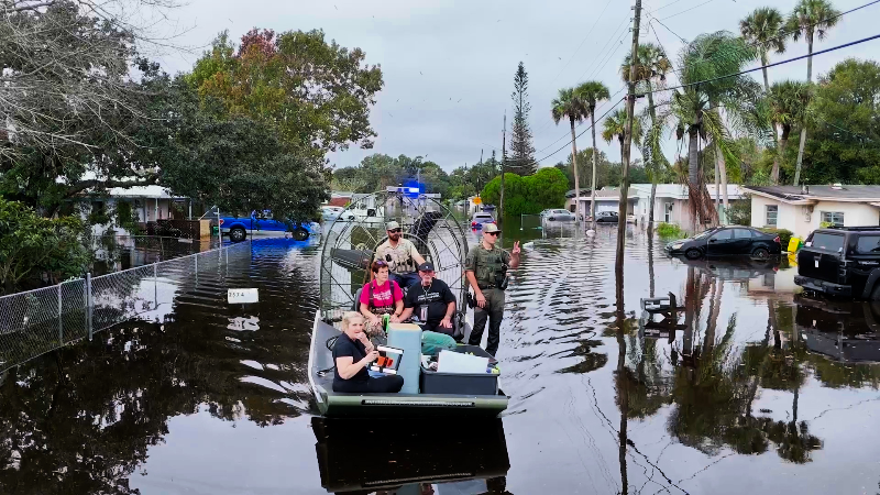
Where the thunderstorms repeat over the same locations, flash flooding can ensue in low-lying and poor drainage areas. Creeks and streams can quickly overflow their banks and flood neighboring land and homes.
Residents and visitors from northern Florida to southern South Carolina should remain alert for the flooding downpours and severe thunderstorms to end the weekend.
"Enabling audible alerts on your cell phone is a great way to receive severe weather bulletins as they are issued so you can seek shelter accordingly," according to AccuWeather Meteorologist Renee Duff.
Download the free AccuWeather app to receive these important notifications.
Cities in Sunday's threat zone include Tallahassee, Florida; Valdosta and Savannah, Georgia; and Charleston, South Carolina.
The strongest thunderstorms can also track near Jacksonville, where the city's Jaquars are playing the Indianapolis Colts.
Even in the absence of severe weather, lightning from any thunderstorm can endanger those outdoors picking out a Christmas tree, putting up holiday decorations or enjoying other festivities.
As soon as thunder is heard, the risk of being struck by lightning is present.
Lightning is being blamed for damaging a home on the north side of Waycross, Georgia, on Sunday afternoon, according to the 911 call center.
Downpours can create dangers for those traveling on stretches of interstates 10, 16, 20, 26, 75 and 95 through the region. Heavy rain and spray from other vehicles can dramatically reduce visibility, and standing water heightens the risk of vehicles hydroplaning when traveling at highway speeds.

Periods of rain and thunderstorms are expected to persist over the area from northern Florida to southeastern North Carolina Sunday night into Monday.
While a few severe thunderstorms may continue to rumble into Sunday evening, residents will have to remain vigilant for more flooding if the rain becomes heavy and pours down on the already saturated soil through Monday.
Drier and progressively cooler air will sweep across the Southeast Tuesday into Wednesday, erasing the record-challenging warmth having those in Florida questioning whether it is really early December.
A potent storm can bring a widespread threat of soaking rain to the South next weekend. Depending on the storm's track, enough warm air can be drawn northward for severe thunderstorms to erupt. If the storm tracks more to the south, disruptive snow and ice can occur along the rain's northern fringe.
Report a Typo