Destructive ice storm, major snow event to pummel northeastern US into Friday
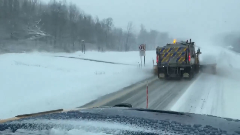
Kalamazoo County, Michigan, saw lake-effect snow accumulations of 3-5 inches that caused icy, slick road conditions. Cleanup now begins in the aftermath.
Snow, ice and rain will lead to more to cause power outages and travel disruptions over a large portion of the northeastern United States into Friday.
The storm, that already produced widespread snow and icy conditions in the central Appalachians and mid-Atlantic, will strengthen and sweep across the balance of the Northeast states through Friday morning.

Download the free AccuWeather app to find out how much snow, ice and rain to expect at your location.
People living in or traveling through portions of Virginia, West Virginia, Maryland, Pennsylvania, New Jersey, New York and New England can expect dangerous driving and walking conditions through Friday morning, even after the precipitation ends.
The more people that stay off the roads, the more efficiently crews will be able to keep up as the storm rages and clean up as it winds down.
First snow of the season from DC to NYC and Boston; Worst winterlike storm so far for others
Six to 12 inches of snow can fall in total from western Maryland to northwestern Maine.
In some areas, it is possible that 1-2 inches of sleet falls on top of the snow.
Where there is little or no ice at the height of the storm, some locations may pick up an AccuWeather Local StormMax™ of 16 inches.

"Students should still do their homework assignments, but there are likely to be many schools delayed or closed on Friday," according to AccuWeather Senior Meteorologist Dave Dombek.
"Likewise, many daycare centers in the heart of the snow and ice may be closed," Dombek said.
For much of the northern I-95 corridor of the mid-Atlantic and southern New England, this already has been the first snow and ice of the season.
Expect major delays and flight cancellations event after precipitation has ended.
On Friday, the heaviest snow will fall from northeast Pennsylvania to northern Maine.
"The duration and amount of snow and sleet will rapidly increase farther north and west of the I-95 swath," according to AccuWeather Chief Meteorologist Elliot Abrams.
"Since it may be snowing at the rate of 1-2 inches per hour near the time of the change to rain near the coast and a change to sleet inland, there is the potential for much heavier snowfall only a few miles northwest of I-95," Abrams said.
A narrow corridor of sleet and freezing rain may occur from southeast New York to eastern Maine.

Icy travel will not be limited to bridges, overpasses and areas that do not receive direct sunlight. Any untreated surface can become slippery. Ice may accrue to 0.25- to 0.50-of-an-inch-thick on elevated surfaces, such as trees, vehicles and utility lines. Expect lengthy and widespread power outages.
As winds pick up on the tail end and after the storm departs, more trees and power lines are likely to come down.
It may be a struggle for some high school and college athletic programs to clear football stadiums and parking areas of snow and ice in time for games scheduled for Friday night and Saturday.
College students who are heading home early for Thanksgiving break may want to delay their trip until later Friday or Saturday when the storm has passed and major roads have been cleared of snow and ice.
Rain to soak mid-Atlantic and southeastern New England
The storm will bring mainly rain from Long Island to southeast New England on Friday.
The rain can be heavy enough to cause flooding in poor drainage areas in southeastern New York and southeastern New England.
Where leaves have fallen and block storm drains and gutters, flooding will be made worse.
The combination of fallen leaves and rain will make for slippery conditions in lieu of snow.
Break from major storms to follow
In the wake of the storm, the air will not be tremendously cold, but temperatures are forecast to be low enough to prompt bands of lake-effect snow from Friday to Saturday.
Only spotty pockets of snow and rain are forecast from this weekend through Wednesday of next week for Thanksgiving travel concerns.

How much snow or rain do you think will fall? Click the image above to play Forecaster Challenge and test your weather prediction skills.


