Coastal flooding, powerful surf spread across mid-Atlantic as nor’easter brews
The long-duration storm is expected to strengthen into a significant nor’easter off the Northeast coast by the weekend.
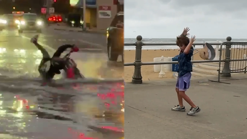
Leslie Hudson was live from Virginia Beach, Virginia, on Sept. 23 as a nor’easter caused impacts along the coast in the region.
Coastal flooding left parts of Norfolk, Virginia, under 1 to 2 feet of water Wednesday morning as a brewing nor’easter pushed seawater toward the mid-Atlantic coast, bringing strong winds and powerful surf.
Overnight rain compounded the tidal flooding, according to AccuWeather Reporter Leslie Hudson, who was covering the storm’s impacts in southeastern Virginia.
[See the forecast: Nor’easter to bring major coastal flooding; hurricane-force gusts in New England]

Flooding in Hampton Roads, Virginia on Sept. 23, 2026. (Image: Leslie Hudson)
Along the Virginia Beach boardwalk, families struggled against sustained winds around 35 mph as large waves rolled toward shore. Wind speeds reached 51 mph at nearby Cape Henry, Virginia, and 45 mph in Lewes, Delaware.
Gale warnings, high surf warnings and coastal flood warnings were in effect along portions of the East Coast. Offshore buoys recorded waves exceeding 13 feet, while waves of more than 9 feet were reported closer to shore along Virginia and the Carolinas.
Storm surge levels at Money Point and Sewells Point in southeastern Virginia were about 2.5 feet early Wednesday.
Outer Banks braces for more coastal erosion

North Carolina DOT crews work to fortify dunes on Pea Island along Highway 12 as a coastal storm brings flooding and threatens more erosion on Sept. 23, 2026. (Image credit: NC DOT)
On North Carolina’s Outer Banks, transportation crews have been reinforcing protective dunes, improving drainage and positioning equipment on Pea, Hatteras and Ocracoke islands. The North Carolina Department of Transportation (NCDOT) warned that difficult driving conditions and temporary closures are possible along N.C. Highway 12 south of the Marc Basnight Bridge, particularly around high tide.
Hatteras and Ocracoke islands were under a coastal flood warning from Wednesday afternoon through Friday night, with 2 to 4 feet of inundation forecast in vulnerable shoreline areas. Breaking waves could reach 10 to 15 feet along Hatteras Island, and repeated high tides could erode protective dunes and push ocean water onto the highway.
Communities along Highway 12 have faced the ongoing threat of coastal erosion with more than 21 homes collapsing into the sea over the past year.
The flooding threat will continue into the weekend. With the Harvest full moon arriving Saturday, astronomical tides will build for several days. King tides can create some of the highest predictable tides of the year, including an elevated risk as winds from a nor’easter push more water into bays, inlets and tidal rivers. AccuWeather meteorologists forecast major coastal flooding during multiple high-tide cycles in southeastern Virginia and northeastern North Carolina from Wednesday through Friday, threatening roads, vehicles, homes and businesses.
The long-duration storm is expected to strengthen into a significant nor’easter off the Northeast coast by the weekend, with impacts spreading into New England Friday and bringing the risk of damaging winds, beach erosion and power outages.
Report a Typo