Flash flood threat to continue in central Texas into Wednesday night
Flash flooding will remain a localized threat in central Texas through midweek, even as storms carry slightly less moisture than on Independence Day.
AccuWeather’s Ali Reid shares the inspiring story of Dan Beazley, who travels to communities impacted by natural disasters to offer comfort, support, and peace to those in need.
More slow-moving storms will affect parts of central Texas into Wednesday night before less rainy conditions unfold, AccuWeather meteorologists warn. Regardless of additional thunderstorms, flash flood search and recovery operations will be hampered by Texas midsummer heat through this week.
Drenching thunderstorms continued to cluster over parts of central Texas on Monday, but the core of the activity was centered farther north than the deadly deluge from Independence Day.
In brief: The disastrous setup from Independence Day

Flash flooding can occur more easily in areas where the soil is saturated or infrastructure is damaged.
The region's arid soil and rugged, rocky terrain are conducive to flash flooding when thunderstorm downpours erupt and linger. The types of soil in the region tend not to hold water like soil in the Midwest and Eastern states.
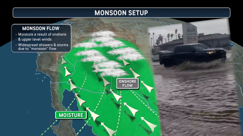
A plume of very humid air from the Gulf persisted for days, triggering random but heavy thunderstorms. Then a storm in the middle layer of the atmosphere swung eastward from the southern Rockies and wrung that moisture out in force. As the storm stalled over the Texas Hill Country, up to seven months' worth of rain fell in two hours on the Guadalupe River basin.

This radar loop from the first several days of July 2025 shows the movement of thunderstorm activity that triggered the catastrophic and deadly flooding in central Texas on Independence Day. (AccuWeather)
Dangerous downpours continue into midweek, just not as volatile
The midlevel storm is gone, but dangerous conditions related to torrential downpours remain a concern through midweek, even though the amount of rain is likely to be considerably less than the 10-20 inches that fell in several hours late last week.
Much of the region from San Antonio and Austin to San Angelo, Texas, was covered by National Weather Service flood watches, with pockets where flash flood warnings were in effect on Monday. Flood watches were lifted for much of Texas as of Tuesday morning, but a few pockets with flash flood warnings remained in some of the central counties of the state.

"There is a concern we have into Wednesday night; there are additional flare-ups or clusters of thunderstorms in parts of central and eastern Texas," AccuWeather Chief On-Air Meteorologist Bernie Rayno said.
On a positive note, the atmosphere does not contain as much moisture as it did late last week. So instead of 10 inches of rain pouring down, there may be 2-3 inches in some of the rainiest spots.
Still, storms capable of producing torrential downpours, localized flash flooding and quick rises on area rivers will continue to affect areas inundated by flash flooding from Friday, as well as areas that managed to avoid the disastrous conditions.
The same ripple in the atmosphere that helped set off isolated but deadly flash flooding in Ruidoso, New Mexico, on Tuesday afternoon will slide southeastward across Texas through Wednesday night. That ripple could enhance the thunderstorm activity and possibly raise the danger factor at the local level.
"Lingering moisture on Wednesday afternoon and evening could also lead to more flash flooding over the New Mexico mountains," Rayno warned.
Storms to dwindle later this week, but the heat will build
On this upcoming Thursday and Friday, thunderstorm activity will tend to become more sparse. While this is not to say that pop-up thunderstorms won't bring flash flooding, the conditions and the nature of the storms--fewer in number-- should bring more routine weather to the region.
By that, we mean July Texas heat.
For search and recovery operations outside of thunderstorms, a significant problem will be the Texas sun and heat. AccuWeather RealFeel® Temperatures will push 100°F during the afternoon on most days.
Crews assisting with the grim task at hand are urged to stay hydrated and take breaks from the heat when possible.

The heat will tend to increase beyond midweek, with actual high temperatures trending upward from near 90 in the Hill Country on Wednesday to the middle to upper 90s from Thursday to Sunday. AccuWeather RealFeel® Temperatures will be some 10-15 degrees Fahrenheit higher than the actual temperature in the afternoon hours.
The next significant uptick in thunderstorm activity is likely to begin this weekend, but mainly over the northwestern parts of Texas, rather than the central and southeastern areas. Still, given the scope of heat providing lift for thunderstorms to grow tall into the atmosphere, the storms could be especially drenching in localized areas with a risk of flash flooding.


Want next-level safety, ad-free? Unlock advanced, hyperlocal severe weather alerts when you subscribe to Premium+ on the AccuWeather app. AccuWeather Alerts™ are prompted by our expert meteorologists who monitor and analyze dangerous weather risks 24/7 to keep you and your family safer.
Report a Typo