Severe Thunderstorm Potential and Long-Range Update
Thunderstorms and rain
Nearly stationary storm over Upper Midwest of the U.S. will continue to pinwheel several disturbances up from the southern U.S. over the next 24 to 36 hours leading to a very unsettled pattern over the eastern half of the U.S. and into eastern Canada.
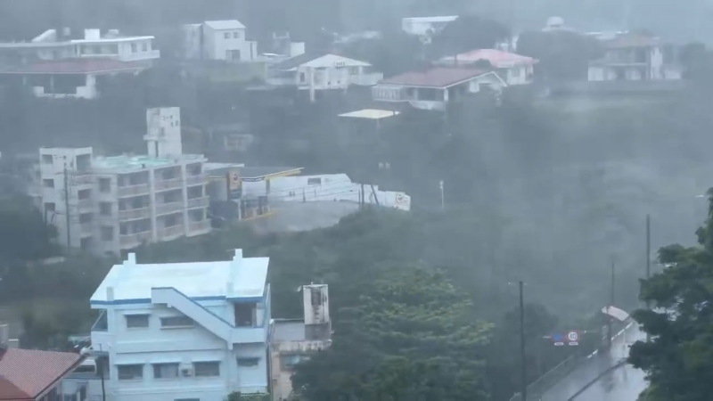
I expect thunderstorms to erupt in the Indiana and western Ohio region later this afternoon as the air mass in that region becomes very unstable. The thunderstorms will then track northeastward and could impact southwestern Ontario this evening, especially from Windsor to Goderich and perhaps as far east as Kitchener tonight, but I suspect the southeast flow off the cold waters of Lake Erie may cause the storms to quickly weaken farther south and east of London.
The greatest risk from these storms will be damaging, straight-line winds and small hail. An isolated tornado cannot be ruled out either, but that is a very low chance. The thunderstorms will likely weaken below severe criteria late tonight with the main issue being heavy downpours across southern/eastern Ontario through Wednesday morning.
Rainfall
Below is the latest ECMWF and GFS forecast model 48-hr precipitation forecasts in inches through Wednesday night.
Clearly, this is the type of system that can bring widespread 25-50 mm rainfall from southern Ontario to Quebec with a plume of Gulf moisture directed into the region.
------
Western Warmth
Very strong ridge of high pressure aloft will remain anchored along the West Coast through Thursday before breaking down. This pattern will keep the weather dry and unseasonably warm for much of BC, especially western BC through Thursday.
By the weekend, a strong northwesterly upper-level flow will direct unseasonably cold air down through the Prairies with temperatures averaging 5-10 degrees C below normal for the weekend.
Long-range forecast model update.....
----
Great Lakes Ice Cover
Still some ice left on Lake Huron, Lake Erie and Georgian Bay as seen by the NASA high resolution image from yesterday. Currently, 26.7 % of the entire Great Lakes are still covered with ice. Normally for this particular week that value is closer to 0.5%.
----
FYI, I will be releasing the AccuWeather Canada Summer outlook next week.
Report a Typo