Tropical Storm Bertha to make first landfall in Louisiana
Tropical Storm Bertha expected to track across the Gulf, bringing flooding rain, gusty winds, dangerous surf and rough seas from Florida to Louisiana and coastal Texas.
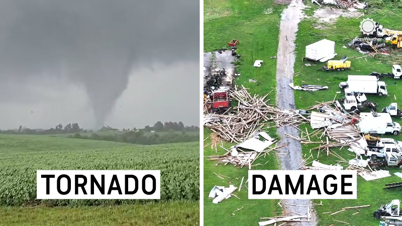
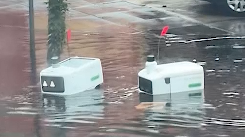
People who dealt with flooding and tornado damage from Tropical Storm Arthur last month are preparing for wind and rain from Bertha.
As Tropical Storm Bertha tracks westward this week, torrential rain, flooding, gusty thunderstorms and building seas are expected along the central Gulf Coast, with landfall anticipated in Louisiana. A second landfall along the upper Texas coast is possible.
Thunderstorms associated with Bertha remained spread over several hundred miles, with most of the activity over the Gulf. The tropical storm has gained some strength since Monday evening, with maximum sustained winds up to 60 mph as of Tuesday afternoon.

This image, captured at midday on Tuesday, July 21, 2026, shows Tropical Storm Bertha, centered over the northeast Gulf. Wispy cirrus clouds can be seen spiraling out over the top of the storm. This is a sign that the storm is being better vented aloft and that some strengthening is likely in the near future. (AccuWeather Enhanced RealVue™ Satellite)
The storm still has at least 24 hours over the open waters of the Gulf, where some additional strengthening is possible. There is a remote chance it briefly reaches hurricane strength (74 mph minimum).
While much of the Gulf Coast was sunny on Monday and Tuesday morning, conditions are expected to deteriorate later this week, especially as the tropical storm drifts westward along the coast.

"The 'hug-the-coast' scenario should hold back wind intensity," AccuWeather Lead Hurricane Expert Alex DaSilva said.
After moving onshore in southeastern Louisiana sometime late Wednesday or Wednesday evening, Bertha is forecast to meander back toward the southern Louisiana coast on Thursday, briefly emerge over the northern Gulf, and then move back onshore in Texas by the end of the week.
Heavy rain, enough to cause urban flooding, will spread westward along the Interstate 10 corridor, especially across southern Louisiana.

The bulk of the rain depicted on the map has already fallen in Florida over the past several days. Most of the rain has yet to fall from the Alabama and Mississippi coasts to Texas.
An elongated swath of 1-4 inches of rain is forecast. Northeasterly winds would keep the heaviest rainfall near the Interstate 10 corridor. Pockets of 4-8 inches are forecast along the Gulf Coast, with an AccuWeather Local StormMax™ of 15 inches.

While the storm would lose wind intensity relatively quickly after interacting with land, most gusts will occur in spiral bands, squalls and thunderstorms. Interests along the Interstate 10 corridor should prepare for tropical-storm-force wind gusts of 40-60 mph, with an AccuWeather Local StormMax™ gust of 75 mph, which is hurricane force.

Torrential rain would be less likely to reach well inland over Texas with this hug-the-coast scenario that takes the storm all or partially over southern Louisiana beforehand.
Storm surge is generally expected to range from 1 to 3 feet, but could be higher if the storm strengthens significantly. The AccuWeather Local StormMax™ surge is 5 feet.

A more concerning scenario for Texas would develop if the storm track shifts just south of Louisiana for a time later this week.
Should the storm travel well to the southwest, which is unlikely at this point, "the Texas Hill Country may be especially vulnerable to downpours due to saturated ground and infrastructure damaged by the catastrophic flooding last week," AccuWeather Meteorologist Breanna Grill said.
Coastal dangers are present, increasing
Conditions on the Gulf will become increasingly hazardous for boaters this week. Sudden squalls can rapidly increase winds and build rough seas.
Brewing tropical storms often produce severe thunderstorms capable of spawning tornadoes and waterspouts.

A waterspout is seen as it dissipates on Lake Pontchartrain in Louisiana as storm clouds enter the area in New Orleans, Tuesday, July 12, 2016. (AP Photo/Gerald Herbert)
Surf will steadily build much of this week from the Florida west coast to the Texas coast, increasing wave energy and raising the strength and frequency of dangerous rip currents.
As wave heights build, the risk of overwash on low-lying coastal roads will also increase.
At this time, there appears to be a minimal threat to offshore petroleum rigs, which are designed to withstand major hurricanes. However, AccuWeather meteorologists will be closely monitoring the progress of the storm and will provide updates on its intensity-based track.


Want next-level safety, ad-free? Unlock advanced, hyperlocal severe weather alerts when you subscribe to Premium+ on the AccuWeather app. AccuWeather Alerts™ are prompted by our expert meteorologists who monitor and analyze dangerous weather risks 24/7 to keep you and your family safer.
Report a Typo