Deadly Noru to batter Japan with flooding rainfall into midweek
Strong waves, winds and rain lashed Japan's southern Kagoshima Prefecture on August 6, as Typhoon Noru passed over. It is expected to make landfall in the Kansai region on August 8.
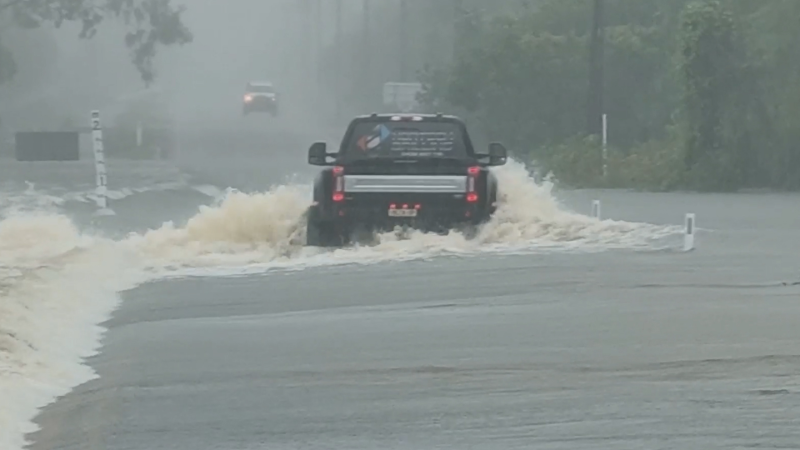
Noru will slowly cross northern Japan into early Wednesday, unloading flooding rain.
Despite weakening from its peak strength, residents and visitors across the region should remain on alert for potential impacts ranging from travel disruptions to evacuations.
Heavy rainfall from the storm will also heighten the risk for landslides across the rugged terrain of northern Honshu.
Seas around central and northern Japan will remain dangerously rough into Wednesday before subsiding later in the week.
Interaction with the rough terrain of Japan has caused Noru to weaken into a tropical rainstorm, with further weakening expected into Wednesday.

Due to the significant weakening, the threat for damaging winds has diminished, but the risk for flooding rain and mudslides will remain high into Wednesday.
Downpours and gusty winds reached Tokyo on Monday evening and additional gusty showers affected the city into Tuesday morning.
Tokyo dodged the worst of the storm as it tracked north and west of the city, inundating parts of central and northern Honshu into Tuesday night.
The heavy rain triggered the evacuation of thousands of people as rivers overflowed their banks in central Honshu.
Locations across northern Honshu can expect total rainfall of 50-100 mm (2-4 inches) with local amounts over 200 mm (8 inches) through Wednesday.
A separate area of low pressure will track from China into Japan, bringing additional downpours from Wednesday through Friday, which could delay cleanup efforts from Noru and cause some localized flooding.
Two deaths and about 50 injuries have already been attributed to Noru, according to public broadcasting corporation NHK.
The cyclone also caused widespread travel disruption, with more than 300 flights canceled as a result of the cyclone’s impacts. Delays and cancellations to rail service were also seen on Monday and Tuesday.
Naze, located on Amami Åshima, was inundated with 680.5 mm (26.8 inches) of rain from Friday to Sunday, local time. The island was also battered by wind gusts of 92 km/h (57 mph).
A wind gust near 145 km/h (90 mph) was reported along the east coast of Shikoku on Monday as the center of the storm passed just to the east.
Noru has been on a long journey across the West Pacific. Noru formed on July 20, then reached super-typhoon status and became the strongest tropical cyclone on the planet so far this year on July 30.
Noru's longevity of 20 days makes it one of the longest-lived cyclones in the basin's history. Rita currently holds the record at 22 days.
Report a Typo