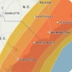
Rounds of snow coming to Chicago into Saturday night As a series of Alberta clipper storms continues to roll from the northern Plains into the Midwest, periods of snow and flurries will create episodes of slippery travel, with enough accumulation to shovel and plow on one occasion into the weekend. Snow squalls may create the most hazardous conditions on area roads and runways during Wednesday morning following rain from Tuesday night. Even though only a small amount of snow may fall at that time, a quick freeze can create sudden icy conditions. A potent clipper storm is forecast to bring 1-3 inches of snow Thursday night. Another clipper storm will bring intermittent snow and slippery conditions Saturday. Temperatures will trend downward into the teens by day and the single digits to below zero at night this weekend, making snow and ice removal challenging.
Wind Flow
This interactive map provides a visual representation of wind speed and direction over the next 24 hours

Maximum Sustained Winds
The projected maximum sustained winds of an active tropical system

Maximum Wind Gusts
The projected maximum wind gusts of an active tropical system


