Just enough cold air will sweep in on the backside of a storm to produce a brief period of snow around the city from late Thursday night to Friday midday. Some roads may become slushy during the heaviest burst of snow on Friday morning rush hour. Farther to the southeast, especially toward northwest Indiana, the snow will last longer as lake-effect becomes involved. In northwest Indiana, up to a few inches of snow may accumulate with slippery travel. Since this will be the first snowfall of the season for the region, extra caution is advised while driving. Deicing-related delays are possible at the airports.
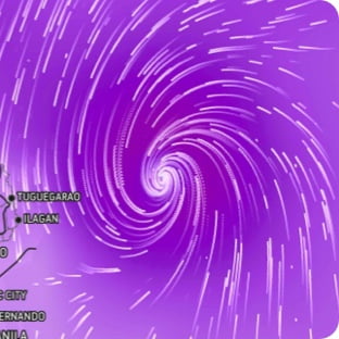
Wind Flow
This interactive map provides a visual representation of wind speed and direction over the next 24 hours
Maximum Sustained Winds
The projected maximum sustained winds of an active tropical system
Maximum Wind Gusts
The projected maximum wind gusts of an active tropical system