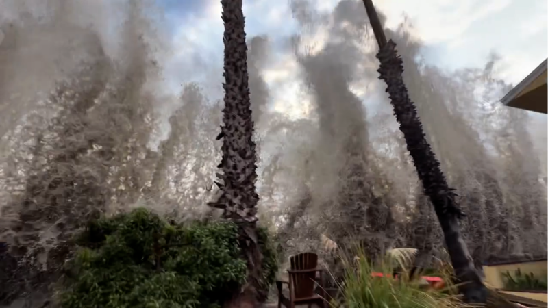
Rain from Edouard is not quite done over Texas
Edouard still has some life left as a tropical rainstorm over eastern Texas. The storm will continue the risk of flash flooding and help with drought easement.
Can a tropical storm come back after falling apart? AccuWeather Meteorologist Ariella Scalese explains how a system can reorganize over warm water during hurricane season.
Tropical Rainstorm Edouard will continue to bring downpours and thunderstorms to parts of northeastern Texas into the end of the week. Edouard has only a slight chance of regenerating, but AccuWeather meteorologists are also keeping an eye on the eastern Gulf, where showers and thunderstorms from Dolly linger.
Edouard's rain has been beneficial in some drought-affected areas, but too much rain falling too quickly has led to flooding elsewhere.

The maximum observed rainfall of 24.36 inches occurred near a small town called Thicket, Texas, located inland from the upper coast of the state.
The heaviest rain from Edouard has already fallen, but the storm's proximity to the Gulf will allow it to continue drawing moisture.

Edouard moved steadily northwest midweek before encountering an area of high pressure to the north—the same system responsible for a massive heat dome over the South Central states.
"Edouard will meander in a general southerly direction into the end of the week, producing an additional 1-2 inches of rainfall with locally higher amounts across portions of eastern Texas," AccuWeather Lead Hurricane Expert Alex DaSilva said.

"Dangerous flash flooding will continue to occur in the heaviest bands into Friday," DaSilva added.
During Thursday afternoon, Houston's Hobby Airport, Texas, picked up 2.41 inches of rain in less than two hours.

Over the Labor Day weekend, what remains of the storm's center will tend to drift into South Texas, where it could bring some drought relief and highly localized flash flooding. Cities such as Austin, San Antonio and even Brownsville, Texas, could experience brief torrential downpours. The localized flash flood risk includes the Texas Hill Country northwest of San Antonio.

By the weekend, showers and thunderstorms will tend to be widely separated. However, there is a small chance that Edouard could regenerate if it wanders near the Gulf's shoreline over the weekend.
Rain from Edouard stopped short of reaching the Dallas Metroplex. Dallas-Fort Worth International Airport continues its streak without measurable rain that began on July 16. From July 16 to Sept. 4, the location receives 3.28 inches of rain on average.

In this image, captured on Friday morning, Sept. 4, 2026, Edouard's downpours (left) have become diffuse over eastern Texas. Clusters of thunderstorms are visible near Louisiana (center) and east of Florida (right). AccuWeather Enhanced RealVue™ Satellite.
Monitoring waters near Florida
Meanwhile, over the eastern Gulf, some of the lingering showers and thunderstorms associated with Dolly could redevelop into next week.
If a tropical storm evolves from the zone of showers and thunderstorms extending from the northeastern Gulf to the southwestern Atlantic, it could receive an entirely new name because Dolly's remnants are now so diffuse.

So far for the 2026 Atlantic season, there have been no hurricanes.
"If we don't get a hurricane in the Atlantic by Sept. 12, that will break the satellite era (1966) record," AccuWeather Meteorologist and Digital Producer Jesse Ferrell said. "If we don't get a hurricane in the Atlantic by Sept. 17, we will break the record back to 1941."


Want next-level safety, ad-free? Unlock advanced, hyperlocal severe weather alerts when you subscribe to Premium+ on the AccuWeather app. AccuWeather Alerts™ are prompted by our expert meteorologists who monitor and analyze dangerous weather risks 24/7 to keep you and your family safer.
Report a Typo