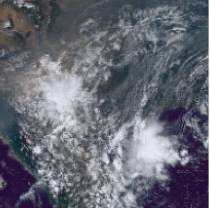
Heavy showers and thunderstorms likely to lead to some travel disruption and flash flooding. What to expect: There is a good chance driving conditions will be affected by spray, standing water and/or hail, leading to longer journey times by car and bus Some flooding of a few homes and businesses possible, leading to some damage to buildings or structures Probably some damage to a few buildings and structures from lightning strikes Delays to train services are possible Some short-term loss of power and other services is likely Further details: Heavy showers and some thunderstorms are expected to continue across northern England and north Wales this morning before easing this afternoon. These are likely to bring 15 to 20 mm in less than an hour in a few places, with 30-40 mm possible over several hours. These accumulations may lead to a few places seeing some flooding. Alongside the rain, there are additional hazards of lightning and hail. What Should I Do? Consider if your location is at risk of flash flooding. If so, consider preparing a flood plan and an emergency flood kit. Give yourself the best chance of avoiding delays by checking road conditions if driving, or bus and train timetables, amending your travel plans if necessary. People cope better with power cuts when they have prepared for them in advance. It's easy to do; consider gathering torches and batteries, a mobile phone power pack and other essential items. If you find yourself outside and hear thunder, protect yourself by finding a safe enclosed shelter (such as a car). Do not shelter under or near trees, or other structures which may be struck by lightning. If you are on an elevated area, move to lower ground. Be prepared for weather warnings to change quickly: when a weather warning is issued, the Met Office recommends staying up to date with the weather forecast in your area.