Go Back
  • For Business
  • |
  • Warnings
  • Data Suite
  • Forensics
  • Advertising
  • Superior Accuracy™
Significant September Nor’easter is brewing for the East Coast. Click for details. Chevron right
Hurricane Polo becomes a Category 5 storm. Click for details. Chevron right

Columbus, OH

61°F
Location Chevron down
Location News Videos
Use Current Location
Recent

Columbus

Ohio

61°
No results found.
Try searching for a city, zip code or point of interest.
Get Premium+
Create Your Account Unlock extended daily and hourly forecasts — all with your free account.
Let's Go Chevron right
Have an account already? Log In
settings
Help
Columbus, OH Weather
Today WinterCast Local {stormName} Tracker Hourly 10-Day Radar MinuteCast® Monthly Air Quality Health & Activities

Around the Globe

Hurricane Tracker

Severe Weather

Radar & Maps

News

News & Features

Astronomy

Business

Climate

Health

Recreation

Sports

Travel

For Business

Warnings

Data Suite

Forensics

Advertising

Superior Accuracy™

Video

Winter Center

Top Stories Severe Weather Hurricane Center Astronomy Heat Alert Climate Recreation Trending Today Health In Memoriam Case Studies Blogs & Webinars

Weather Blogs / WeatherMatrix

Pros and Cons to Pennsylvania Severe Weather Situation

By Jesse Ferrell, AccuWeather meteorologist

Published May 7, 2010 12:40 PM EDT | Updated May 7, 2010 2:36 PM EDT

Copied

UPDATE 3 PM: The new run of the 4-KM WRF model's simulated radar for 1 AM (shown below) worries me a little because the line is more split up than the map I posted this morning, with storms going across the northern and southern parts of the state but not the middle. Without a solid line moving across the state, there's less guarantee that those in western PA will see lightning tonight. However, the SPC's new outlook has not changed for Pennsylvania since 8 AM this morning. At this point, it's just "wait & see."

The western third of Pennsylvania has the highest risk for severe weather so far this season. That's awfully close to AccuWeather HQ so I'll probably be up late tonight watching the lightning roll in (watch my Facebook Profile and the Pennsylvania Storm Chasers Facebook Group for more info on what myself, and other local storm chasers and weather enthusiasts will be doing).

Some things to keep in mind for Pennsylvania for weather enthusiasts and storm chasers:

PROS:

1. Everyone in the media seems to be in agreement that this will be the most significant severe weather outbreak in the Ohio Valley this year, and that tornadoes are likely. The SPC has issued their first Moderate Risk for the Ohio Valley in 2010. The question is: How far east can it get?

2. The 4-KM WRF model, which I rely on heavily, is excited about this storm (it wasn't last Sunday when SPC's Slight/30% risk busted). Here's a look at the simulated radar for 1 AM Eastern:

3. The storms are coming overnight (and per the above, are likely to remain strong at least through Central Pennsylvania) so this will be a great setup for lightning photography. I may actually stay up for this one.

4. The storms are approaching from the Northwest, which (at least for here) is a good, perpendicular direction to photographers. Because of the orientation of the mountains in Pennsylvania, it's hard to see to the southwest, where storms often come from.

5. This is in line with our tornado season forecast.

CONS:

1. The real action is going to be in Ohio, not Pennsylvania, where tornadoes are likely. Yes, the SPC's moderate risk was touching the state border at 12Z (13Z update moved it slightly west) but the storms will lose some energy before entering the state. If you look at the Categoricals, wind is the biggest threat by far; hail and tornadoes are possible, and the chance fades as you get east -- eastern PA will be unlikely to see much at all.

Although good (1.0-2.0 Supercells / Tornadoes Likely) values of the EHI (Energy Helicity Index) are aligned with the storms at 00Z on the NMM computer forecast model, they aren't by the time it gets into PA (see map below), even though the values are still good. It doesn't matter how good the EHI is if there are no storms. This is a common way that people get fooled when using the EHI (read more about Severe Weather Indicies here).

2. There's still room for a "bust" but it seems unlikely. Technically, the entire state was in a 30% categorical risk last Sunday when few storms formed (today the western part is in a 30% wind risk).

3. The storms are coming after dark so you're not going to be able to get good cloud timelapse or daytime lightning photos. You also won't be able to see what's coming, which will make storm chasing more dangerous.

4. Dew points are pitiful so far today (I'm sitting at 39) and some clouds are limiting heating right now in the northwestern part of the state, but if you believe MeteoMadness Man, nothing happening now matters because of this energetic storm system, it will blow it all away.

5. There will likely be property damage and casualties from the storm, especially in Ohio, something that's never acceptable to trade for "good" storm chasing or photography opportunities. But, you can't control the weather. What we can do is get trained spotters out in front of the storms to assist in warnings.

Report a Typo
Weather News

Weather News

Why meteorological, astronomical fall start on different dates

Sep. 21, 2026
video

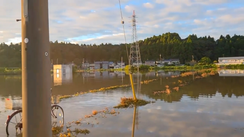
Flooding and landslides leave four dead in coastal Japan

Sep. 22, 2026
Weather News

2 pilots killed while battling Dome Fire in Yosemite

Sep. 22, 2026
Show more Show less Chevron down

Topics

Top Stories

Severe Weather

Hurricane Center

Astronomy

Heat Alert

Climate

Recreation

Trending Today

Health

In Memoriam

Case Studies

Blogs & Webinars

ABOUT THIS BLOG
WeatherMatrix
Jesse Ferrell
AccuWeather Meteorologist and Social Media Manager Jesse Ferrell covers extreme weather and the intersection of meteorology and social media.
  • Astronomy
    with Dave Samuhel
  • Canadian weather
    with Brett Anderson
  • Global climate change
    with Brett Anderson
  • Global weather
    with Jason Nicholls
  • Northeast US weather
    with Elliot Abrams
  • Plume Labs on Air Quality
    with Tyler Knowlton
  • RealImpact of weather
    with Dr. Joel N. Myers
  • WeatherMatrix
    with Jesse Ferrell
  • Western US weather
    with Brian Thompson

Featured Stories

Weather News

California under state of emergency ahead of 'historic' El Niño

11 hours ago

Astronomy

Harvest Moon 2026: When to see September’s full moon

1 day ago

Weather News

Lake Tahoe’s poisoned-pine mystery: $147,000 reward offered

1 day ago

Recreation

Body of missing hiker recovered in Washington's Olympic National Park

1 day ago

Weather News

These cities have had more 100+ degree days this year than ever

4 days ago

AccuWeather Weather Blogs Pros and Cons to Pennsylvania Severe Weather Situation
Company
Proven Superior Accuracy™ About AccuWeather Digital Advertising Careers Press Contact Us
Products & Services
For Business For Partners For Advertising AccuWeather APIs AccuWeather Connect Personal Weather Stations
Apps & Downloads
iPhone App Android App See all Apps & Downloads
Subscription Services
AccuWeather Premium AccuWeather Professional
More
AccuWeather Ready Business Health Hurricane Leisure and Recreation Severe Weather Space and Astronomy Sports Travel Weather News Winter Center
Company
Proven Superior Accuracy™ About AccuWeather Digital Advertising Careers Press Contact Us
Products & Services
For Business For Partners For Advertising AccuWeather APIs AccuWeather Connect Personal Weather Stations
Apps & Downloads
iPhone App Android App See all Apps & Downloads
Subscription Services
AccuWeather Premium AccuWeather Professional
More
AccuWeather Ready Business Health Hurricane Leisure and Recreation Severe Weather Space and Astronomy Sports Travel Weather News Winter Center
© 2026 AccuWeather, Inc. "AccuWeather" and sun design are registered trademarks of AccuWeather, Inc. All Rights Reserved.
Terms of Use | Privacy Policy | Cookie Policy | About Your Privacy Do Not Sell or Share My Personal Information | Data Sources

...

...

...