Go Back
  • For Business
  • |
  • Warnings
  • Data Suite
  • Forensics
  • Advertising
  • Superior Accuracy™
Significant September Nor’easter is brewing for the East Coast. Click for details. Chevron right
Hawaii on alert for Tropical Storm Nolo. Click for the forecast. Chevron right

Columbus, OH

59°F
Location Chevron down
Location News Videos
Use Current Location
Recent

Columbus

Ohio

59°
No results found.
Try searching for a city, zip code or point of interest.
Get Premium+
Create Your Account Unlock extended daily and hourly forecasts — all with your free account.
Let's Go Chevron right
Have an account already? Log In
settings
Help
Columbus, OH Weather
Today WinterCast Local {stormName} Tracker Hourly 10-Day Radar MinuteCast® Monthly Air Quality Health & Activities

Around the Globe

Hurricane Tracker

Severe Weather

Radar & Maps

News

News & Features

Astronomy

Business

Climate

Health

Recreation

Sports

Travel

For Business

Warnings

Data Suite

Forensics

Advertising

Superior Accuracy™

Video

Winter Center

Top Stories Severe Weather Hurricane Center Astronomy Heat Alert Climate Recreation Trending Today Health In Memoriam Case Studies Blogs & Webinars

Weather Blogs / WeatherMatrix

Gustav Hype, Rain in Feet, Storm Surge Maps

By Jesse Ferrell, AccuWeather meteorologist

Published Aug 31, 2008 5:48 PM EDT | Updated Aug 31, 2008 9:24 PM EDT

Copied

UPDATE (9 PM): Gustav is looking a little better on satellite now and TWC is talking that it may hit as a major Category 3, because NOAA's hurricane hunters have reported dropping pressure. Tonight, keep an eye on PSTL1, a coastal station on the southeasternmost Louisiana [Google Map]... they are getting the outer rainbands now and are gusting to 54 knots (LIVE GRAPH).

UPDATE (7 PM): The only observation anywhere close to the storm this afternoon was from a ship considerably to the Northeast of the storm which reported 36-foot waves and sustained winds of 78 mph (NDBC). Buoy #42003 which I quoted this morning made it to 78 mph with 34.4 foot waves before disappearing from the scope - it probably became adrift, which it has had a habit of doing this year. Here's a regional shot from AccuWeather.com RadarPlus showing wind (arrows), pressure (colors), satellite and radar at 7 PM:

rps8-31-2008_6-59-23_PM

Interesting Comments From The Media:

1. 1.9 million people have left Louisiana, according to estimates. Less than 10,000 people remain in New Orleans (Governor via FoxNews).

2. A military spokesman on CNN pointed out that if people would text-message, rather than calling, on their cell phones today, the cell phone system would be more likely to not die due to traffic. This is an interesting technological development I hadn't thought of.

3. A levee spokesperson on Fox News said that the Category of the storm surge is irrelevant when it comes to storm surge and that Katrina, a Cat 3 at landfall, produced a Cat 5 storm surge. I am mystified by this comment since the Saffir Simpson storm surge scale is clear. What he should have pointed out was that the direction of the storm surge at landfall is what is most important. The government has a storm surge model which predicts it; the probability of a 4-foot storm surge is shown below - you can see 8 foot here. This AccuWeather forecast indicates a 10-18 foot surge may occur in southeastern most Louisiana. AT THIS TIME the government map below would indicate that storm surges of over 8 feet only have a 20-30% probability of happening in New Orleans. But, it will only take one levee break to flood the city like during Katrina.

ORIGINAL POST:

We said in a press release this afternoon something that I was tempted to say this morning: Hurricane Gustav's time to turn into a monster like Katrina is over. The storm is disorganized with no eye, and may not even be the Category 3 strength that the last NHC bulletin claims.

UPDATE: I've tagged all my old Hurricane Katrina posts in "Categories" to your right, if you're interested in taking a trip down memory lane for that historic storm.


LIVE SATELLITE OF "GUSTAV" (PREMIUM | PRO) | BUOY/SHIP OBS (NEW!)

atl_AL08_thumb
atl_AL07_thumb
isaeFLS

Model Spread Maps FOR GUSTAV & HANNA [JessePedia] courtesy the AccuWeather.com Hurricane Center. ARCHIVE AVAILABLE!

DATA DISCLAIMER: This blog is written periodically on no certain schedule and may not contain the latest information on specific Tropical Storms, or main contain unofficial information. More up-to-date information is available in our our Hurricane Center (including the official AccuWeather.com EyePath™ for storms), in our Weather Headlines (at right), on our Breaking Weather News Page, and from official government channels. Compare forecasts on our Google Hurricane Tracker! IGNORE THIS BLOG in cases of protection of life and property (Terms & Conditions)

Why then all the media hype of Gustav being a Cat 5 right now? The problem was, we meteorologists were hoping for a "biblical" storm and were looking only at sea-surface temperatures, which is only part of the equation. We either ignored, or didn't see coming, the affects of an upper-level trough/low to the west which not only directed Gustav on his present path, but kept him from strengthening today. AccuWeather.com Senior Expert Meteorologist Dan Kottlowski said in an interview,

That said, there are three important things to state:

1. The storm is still near the strength that Katrina was at landfall and will still cause considerable damage. 2. The levee system in New Orleans may still fail due to the different approach angle of this storm, or because they weren't strong enough for a Cat 3 storm 3. A much-better-prepared coast has evacuated better and less lives will be lost because of it. 4. The storm will slow down after landfall, creating extensive, perhaps historic flooding where rain will be measured in feet.

Below is the current prediction from the GFS Forecast Model [JessePedia] for rainfall over the next week. Black areas indicate over a foot.

Much like Fay, we will likely see amounts in excess of that, probably over 20 inches, possibly three feet as we did with Tropical Storm Allison in 2001. I will never forget putting this graphic on the AccuWeather.com Headlines:

Here's an eerie photo of downtown New Orleans last night - in stark contrast to Hurricane Katrina, when the bars were filled with people - and the media.

Report a Typo
Weather News

video

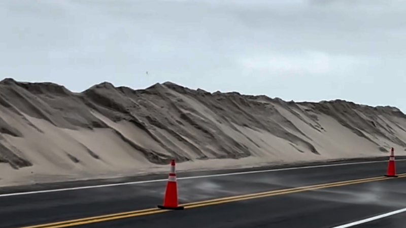
North Carolina strengthens dunes with nor’easter impacting coast

Sep. 24, 2026
Weather News

Sea turtle makes nesting history on California beach

Sep. 24, 2026
Weather News

2 pilots killed while battling Dome Fire in Yosemite

Sep. 22, 2026
Show more Show less Chevron down

Topics

Top Stories

Severe Weather

Hurricane Center

Astronomy

Heat Alert

Climate

Recreation

Trending Today

Health

In Memoriam

Case Studies

Blogs & Webinars

ABOUT THIS BLOG
WeatherMatrix
Jesse Ferrell
AccuWeather Meteorologist and Social Media Manager Jesse Ferrell covers extreme weather and the intersection of meteorology and social media.
  • Astronomy
    with Dave Samuhel
  • Canadian weather
    with Brett Anderson
  • Global climate change
    with Brett Anderson
  • Global weather
    with Jason Nicholls
  • Northeast US weather
    with Elliot Abrams
  • Plume Labs on Air Quality
    with Tyler Knowlton
  • RealImpact of weather
    with Dr. Joel N. Myers
  • WeatherMatrix
    with Jesse Ferrell
  • Western US weather
    with Brian Thompson

Featured Stories

Weather News

California under state of emergency ahead of 'historic' El Niño

1 day ago

Hurricane

Category 5 Hurricane Polo strengthens to 2nd strongest on record

22 hours ago

Astronomy

Harvest Moon 2026: When to see September’s full moon

2 days ago

Weather News

Lake Tahoe’s poisoned-pine mystery: $147,000 reward offered

2 days ago

Hurricane

Atlantic breaks 60-year record with no hurricanes through Sept. 12

2 days ago

AccuWeather Weather Blogs Gustav Hype, Rain in Feet, Storm Surge Maps
Company
Proven Superior Accuracy™ About AccuWeather Digital Advertising Careers Press Contact Us
Products & Services
For Business For Partners For Advertising AccuWeather APIs AccuWeather Connect Personal Weather Stations
Apps & Downloads
iPhone App Android App See all Apps & Downloads
Subscription Services
AccuWeather Premium AccuWeather Professional
More
AccuWeather Ready Business Health Hurricane Leisure and Recreation Severe Weather Space and Astronomy Sports Travel Weather News Winter Center
Company
Proven Superior Accuracy™ About AccuWeather Digital Advertising Careers Press Contact Us
Products & Services
For Business For Partners For Advertising AccuWeather APIs AccuWeather Connect Personal Weather Stations
Apps & Downloads
iPhone App Android App See all Apps & Downloads
Subscription Services
AccuWeather Premium AccuWeather Professional
More
AccuWeather Ready Business Health Hurricane Leisure and Recreation Severe Weather Space and Astronomy Sports Travel Weather News Winter Center
© 2026 AccuWeather, Inc. "AccuWeather" and sun design are registered trademarks of AccuWeather, Inc. All Rights Reserved.
Terms of Use | Privacy Policy | Cookie Policy | About Your Privacy Do Not Sell or Share My Personal Information | Data Sources

...

...

...