Super Typhoon Champi damages Guam, bound for Taiwan
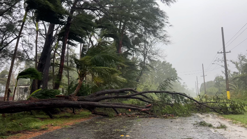
Super Typhoon Champi made a close pass to Guam, ripping off roofs and knocking down trees on the island. It is the third typhoon to affect the Mariana Islands this year.
The center of the storm passed just miles south of Guam on Oct. 18. Luckily, residents were spared from greater damage.
Super Typhoon Champi is barreling across the western Pacific Ocean and is making a beeline toward Taiwan, where it is predicted to make landfall in the coming days.
Champi passed within 12 miles of Guam's southern tip on Sunday. While the eye's core of extreme winds remained mostly offshore, it was close enough to cause damage to homes and knock down trees on the island. How much damage was done in the island's southernmost region has not yet been assessed.

The Red Cross reported that it supported 15 shelters on the four islands, with over 1,000 residents taking refuge from the storm. Afterward, they noted, "Multiple communities have lost power and water, with as many as 170 wells not operating. Some water systems have been down since Super Typhoon Sinlaku hit the islands in April."
Guam is the largest island in the chain, with 150,000 residents, but the Commonwealth of the Northern Mariana Islands (CNMI) spans 14 islands. All north of Guam, they total a population of around 50,000, most of whom live on Saipan, Tinian and Rota.
Champi is the third typhoon to impact the CNMI in the last six months. Super Typhoon Sinlaku hit Saipan on April 14, followed by Super Typhoon Bavi on July 6, which made landfall on Rota.

Where is Super Typhoon Champi going now?
AccuWeather.com Senior Meteorologist Jason Nicholls says that Super Typhoon Champi, a Category 4 equivalent, is over the Philippine Sea, well north of Yap Island, and is moving toward the west-northwest. A west-northwest track is expected over the next few days, with the storm maintaining intensity as it approaches Taiwan.
Champi is forecast to bring heavy rain and strong winds to Taiwan Thursday night, Oct. 22, into Saturday, Oct. 24, then eastern China Friday night, Oct. 23, through Sunday, Oct. 25. Rainfall will total up to 24 inches (600 mm), with an AccuWeather Local StormMax™ of 36 inches (900 mm), with the heaviest rain expected in eastern Taiwan.

Winds will gust up to 140 mph (225 km/h), with an AccuWeather Local StormMax™ of 160 mph (260 km/h), with the strongest winds expected in eastern Taiwan. The rain and wind will result in areas of flooding, mudslides, structural damage and extended power outages, as well as logistical and transportation delays.

Coastal inundation is likely in eastern Taiwan. The combination of rain, wind and coastal inundation will result in Champi being rated a 3 on the AccuWeather RealImpact™ Scale for Tropical Cyclones in Taiwan and a 1 in eastern China.
Report a Typo