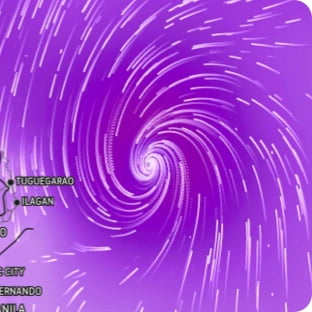
This product covers southeast North Carolina and northeast South Carolina **TROPICAL STORM CHANTAL WILL APPROACH THE SOUTH CAROLINA COAST TONIGHT** NEW INFORMATION --------------- * CHANGES TO WATCHES AND WARNINGS: - None * CURRENT WATCHES AND WARNINGS: - A Tropical Storm Warning is in effect for Central Horry, Coastal Brunswick, Coastal Georgetown, Coastal Horry, Coastal New Hanover, Coastal Pender, and Inland Georgetown * STORM INFORMATION: - About 170 miles south-southwest of Wilmington NC or about 120 miles south of Myrtle Beach SC - 31.9N 78.7W - Storm Intensity 45 mph - Movement North or 360 degrees at 7 mph SITUATION OVERVIEW ------------------ Tropical Storm Chantal will approach the South Carolina coast tonight, strengthening slightly before landfall. The main impact for the Carolinas will be locally heavy rainfall with potential for isolated flooding tonight through Sunday. Strong rip currents and dangerous surf are also expected. Hazardous surf conditions will continue through early next week. POTENTIAL IMPACTS ----------------- * FLOODING RAIN: Protect against dangerous rainfall flooding having possible significant impacts across coastal northeast SC and southeast NC. Potential impacts include: - Moderate flooding from rainfall may prompt some evacuations and rescues. - Rivers and streams may rise and overspill their banks in a few places, especially in the typical prone locations. Small creeks and ditches may overflow. - Flood waters may enter some structures. Underpasses, low-lying spots along roadways, and poor drainage areas may become submerged by rising water. Some secondary streets and parking lots may flood as storm drains and retention ponds overflow. - Driving conditions will become hazardous, and some road closures can be expected. Protect against locally hazardous rainfall flooding having possible limited impacts along and west of I-95. * OTHER COASTAL HAZARDS: Life-threatening rip currents possible at all area beaches Saturday and Sunday. High surf forecasted for the beaches of northeast SC and Brunswick county Saturday through Sunday, with breaking wave heights of six feet likely and minor beach erosion possible. * WIND: Protect against hazardous wind having possible limited impacts across southeast North Carolina and northeast South Carolina. Potential impacts include: - Damage to porches, awnings, carports, sheds, and unanchored mobile homes is possible. Unsecured lightweight objects may be blown about. - Some large limbs may break from trees. A few shallow rooted or weak trees may snap or be knocked down. Some fences and roadway signs will be damaged. - A few roads may become impassable due to debris, particularly within urban or heavily wooded places. Hazardous driving conditions are possible, especially for high profile vehicles on bridges and other elevated roadways. - Scattered power and communications outages are possible. * SURGE: Protect against locally hazardous surge having possible limited impacts across coastal northeastern SC and coastal southeastern NC. Potential impacts in this area include: - Localized inundation and minor overwash are possible, mainly along immediate shorelines and other vulnerable low-lying areas along the coast. Low spots along waterways and tidal creeks may also be impacted. - Some portions of near-shore roads and parking lots may become covered by surge water. Driving conditions may become hazardous in places where the surge covers the road. - Moderate beach erosion is possible, mainly in vulnerable locations along the oceanfront. - Minor damage to marinas, docks, boardwalks, and piers is possible. A few small craft may break away from moorings if not properly secured. - Navigation may be difficult near inlets and waterways, as navigational aids may be off station or missing. Elsewhere across southeast North Carolina and northeast South Carolina, little to no impact is anticipated. * TORNADOES: Protect against a tornado event having possible limited impacts across southeast North Carolina and northeast South Carolina. Potential impacts include: - The occurrence of isolated tornadoes can hinder preparedness actions during tropical events. - A few places may experience tornado damage, along with power and communications disruptions. - Tornadoes can cause damage to trees, vehicles, boats, and buildings. Unsecured mobile homes and poorly constructed structures are particularly vulnerable. PRECAUTIONARY/PREPAREDNESS ACTIONS ---------------------------------- * OTHER PREPAREDNESS INFORMATION: Now is the time to bring to completion all preparations to protect life and property in accordance with your emergency plan. Outside preparations should be wrapped up as soon as possible before weather conditions completely deteriorate. Any remaining evacuations and relocations should be expedited before the onset of tropical storm force wind. Check-in with your emergency points of contact among family, friends, and workmates. Inform them of your status and well-being. Let them know how you intend to ride out the storm and when you plan to check-in again. Keep cell phones well charged and handy. Also, cell phone chargers for automobiles can be helpful after the storm. Locate your chargers and keep them with your cell phone. In emergencies it is best to remain calm. Stay informed and focused on the situation at hand. Exercise patience with those you encounter. Be a Good Samaritan and helpful to others. If you are a visitor and still in the area, listen for the name of the city or town in which you are staying within local news updates. Be sure you know the name of the county or parish in which it resides. Pay attention for instructions from local authorities. Closely monitor NOAA Weather radio or other local news outlets for official storm information. Be ready to adapt to possible changes to the forecast. * ADDITIONAL SOURCES OF INFORMATION: - For information on appropriate preparations see ready.gov - For information on creating an emergency plan see getagameplan.org - For additional disaster preparedness information see redcross.org NEXT UPDATE ----------- The next local statement will be issued by the National Weather Service in Wilmington NC around 11 PM EDT, or sooner if conditions warrant.
